5.2. Forward Modeling
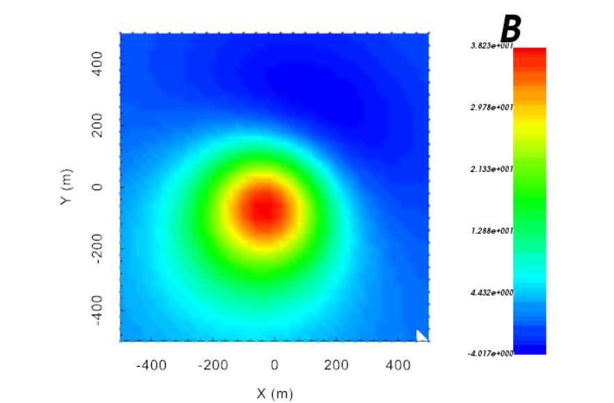
Here, the code magfor3d_60.exe is used to predict the data for an airborne survey. For simplicity, the magnetic data are predicted on regular grid of data points with a horizontal spacing of 40 m in both the Easting and Northing directions. The flight height is 30 m for all data points. The Earth’s field had an inclination of 65 degrees, a declination of 25 degrees and an intensity of 50,000 nT. Files relevant to this part of the example are in the sub-folder fwd. For this example, we use the model that were created in the example “create model”.
Before running this example, you may want to do the following:
Download and open the zip folder containing the entire Mag3d example (if not done already)
forward modeling does not required and input file
The total magnetic intensity data output by the simulation is shown below.